
Exceptional Hiking In Lake Arrowhead (CA): 12 Easy, Medium & Hard Trails That Locals Love!
If there’s one word to best describe the Lake Arrowhead area, it’s “scenic.” This area is a little pocket of paradise nestled into the San Bernardino National Forest mountains and affectionately referred to as “The Alps of Southern California.”
You can experience the endless beauty of this place largely untouched by commercialization thanks to some wonderful Lake Arrowhead hiking trails. There is a fantastic maze of trails throughout the area, and they give you an excellent opportunity to get out and stretch your legs amongst wildlife and stunning natural landscape.
In fact Lake Arrowhead hosts more than 4 million annual tourists with its array of boating, water skiing, fishing, and hiking options. The body of water is an artificial lake on Little Bear Creek, a tributary of Deep Creek and Mojave River. With its varied natural views, this area instills a deep appreciation for nature to anyone who ventures to the quaint village-like town.
Below we share with you our favourite easy, moderate, and harder Lake Arrowhead hiking trails. So there should be something for everyone. From glorious views to even bathing in hot springs!
Many of the trails will require an ‘Adventure Pass’. You can get one of those by clicking here. Enjoy!

Easy Hiking Trails in Lake Arrowhead
Grab your sunscreen and a sun hat and hit a few of the more accessible hiking trails in Lake Arrowhead. Several easy hikes are available that are great for kids. Go enjoy some time out in nature, and absorbing the views on offer around Lake Arrowhead.
1. Will Abell Memorial Trail
The Will Abell Memorial Trail is one of the most accessible Lake Arrowhead hiking trails. The nature around this trail is considered one of the most “artistic” parts of the mountain and is aptly named after a local artist, the late Will Abell.
He shared much of his time and attention on the trail’s landscape and was a great supporter of nature in the area. This hike is also in one of the few areas in Lake Arrowhead that has remained mostly free of commercialization. Some of the other forested areas have been devastated by drought and wildfire. But this is one section of the landscape that has remained full of its natural beauty.
It’s a wonderful easy hike in nature, but can be a difficult hike when done in winter due to snow.
Length: 2-mile loop
Duration: 1h 5m
Elevation: 128m
2. Little Bear Creek Trail
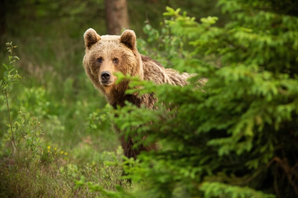
This is a pleasant and lightly trafficked hike near Lake Arrowhead, where you might even encounter a bear! Bears are common in the region, and many people who have hiked this trail have reported encounters with these incredible animals. Remember to be prepared for these situations when hiking in Lake Arrowhead.
This out and back trail requires an Adventure Pass so you’ll have to get one in advance, but you can also walk your dog on a leash on this hike. If you are looking for a slightly longer hike with excellent scenery, then the Little Bear Creek Trail is a perfect option.
Length: 3.7 miles
Duration: 2h 5m
Elevation: 247m
3. Metate Trail
If history excites you, the Metate Trail is an excellent hiking trail in Lake Arrowhead. There is fascinating history embedded in the region, and the Metate Trail, otherwise known as the Indian Rock Trail, is a perfect example.
The trail begins east of Rock Camp Station on Highway 173 and leads to bedrock mortars that were used by the Serrano Indians to grind acorns and make flour. The bedrock mortars, formed from the grinding action of mortar and pestle stones, were easier to use than carrying mortar stones through the area, so became a regular stop.
The Lake Arrowhead’s Woman’s Club placed a stone monument at the site to honor the heritage of the bedrock mortars in Lake Arrowhead, which is where this hike will take you! This trail is a great way to learn about history, while enjoying some wonderful forest scenery.
Length: 2 miles
Duration: 1h
Elevation: 78m
4. Heaps Peak Arboretum
While nature is a great enticement to hit any hiking trail, witnessing firsthand the depth of history that the San Bernardino Forest holds is a great way to spend a day too.
First, a quick history lesson! Fred Heaps founded a ranch in the San Bernardino Mountains and shortly after his death, the area became a lumber harvesting operation. In the 1920s, a wildfire decimated the area, and new trees were planted to revitalize plant life. The site was officially named the Heaps Peak Reforestation Project. The land was again destroyed by fire in the 1950s and became an illegal dumping ground.
With the motivation to return the land to its pristine condition, George Hessman sought permission from the Forest Service in 1982 to turn the land into a series of hiking trails. More than 175 trees were planted around the area, and the hiking trails cleared. They then fenced in the area to discourage illegal dumping and encourage people who love and appreciate nature to use the trails!
This trail is an easy 1-mile loop but requires an Adventure Pass for parking, although visiting the Arboretum is free. There is a magnificent view of the local mountains and the San Bernardino country, lined with many pine trees. Look out for the pretty Monarch butterflies!
The Arboretum is closed during the winter months and is best experienced during spring when the mountain flowers are in bloom. The paved path makes it stroller and wheelchair-friendly too.
Length: 1-mile loop
Duration: 20m
Elevation: 21m
5. Lake Arrowhead Reservoir Loop
This scenic route makes a round trip around the Lake Arrowhead Reservoir. This loop does belong to the residents of the Lake Arrowhead properties that sit around the lake, and requires permission from a resident to walk it as it is on private property.
Even though it is not open to the public, it makes for an excellent trail, allowing you to see all the beauty that the lake has to offer. If you have the opportunity to get permission from a resident, it is an unforgettable way to see the beauty of this lake.
Length: 9.4 miles
Duration: 4h 10m
Elevation: 192m

Moderate Hiking Trails in Lake Arrowhead
These moderate hikes will be perfect for you if you’re looking for a more intense Lake Arrowhead hiking trail to make your thigh muscles burn. There is so much nature to see on these Lake Arrowhead hiking trails.
1. Pacific Crest Trail
The more difficult hikes begin to offer opportunities to link with the Pacific Crest Trail that runs through the area.
The Pacific Crest Trail is a special project that links 2600 miles of hiking trails between Mexico and Canada along the Pacific Coast of Northern America. This incredible long-distance trail offers excellent views, strenuous hikes, and some of the best experiences of nature in Northern America!
Approximately 40 miles of this trail crosses the Mountaintop Ranger District and are accessible in the region with some planning. Several trails connect and intertwine throughout the Lake Arrowhead area, offering a wide array of options for enjoyable hiking.
Some of the hikes that form part of the Pacific Crest Trail in Lake Arrowhead are:
1). Devils Hole to Mojave River Dam, a 13 mile, very strenuous hiking trail.
2). The Little Bear Springs to Crab Flats Road hike is 6.5 miles of moderate hiking.
3). Crab Flats Road to Deep Creek Bridge, is six miles of moderate hiking.
If a more intense and immersive experience of nature appeals to you, planning a hike along any of these routes is an excellent idea.
2. North Shore Recreation Trail
The trail begins just behind the North Shore Campground on Hospital Rd off Highway 173. The trail then descends on the Little Bear Creek Trail and intersects 1 mile above the Splinter’s Cabin Trailhead.
The seven-year drought and Old Fire in 2003 took its toll on the trees along the trail to a great extent, so this hike will give you a good idea of the effects that wildfires and droughts have on the region. If you are interested in nature and the effects of changing conditions in a region, this is the hike for you.
Length: 1.7 miles round trip
Duration: 1h
3. Exploration Trail
The exploration trail is a 4.5-mile one-way trail which is a family-friendly hiking route designed by children with the U.S Forest Service! It can be a little hard going at times but is well worth the effort thanks to great views and the opportunity to see Sugar Pines – the tallest pine tree species in the world!
This trail is heavily trafficked and used for horse riding, mountain biking, and running. The trail makes for a great snowshoe or cross-country skiing trek during the winter too.
This hike is near the Trail of the Phoenix (an easy hiking trail) and can be accessed from Keller Road. Hikers can also bring their dogs as long as they are on a leash.
Length: 9 miles (there and back)
Duration: 4h 30m
Elevation: 455m

Hard Hiking Trails in Lake Arrowhead:
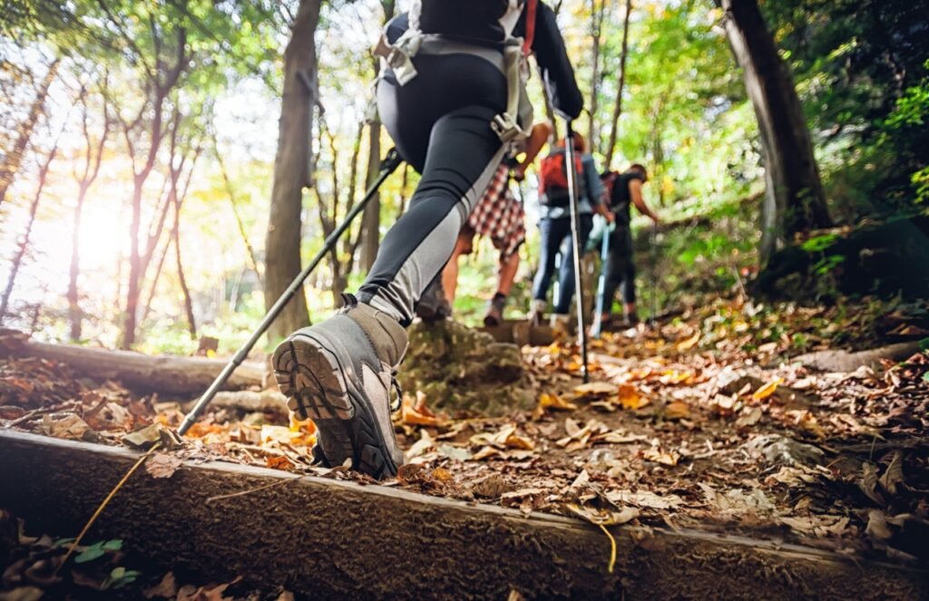
Are you looking for something a bit more adventurous? Here are some of the more challenging hiking trails in Lake Arrowhead. These hikes offer diverse areas to explore and enjoy. More strenuous trails require you to be alert, prepared, and fully stocked up with sunblock, water, and snacks to hike safely and with confidence.
1. Little Green Valley Trail
Are you looking for a tougher trail with a great view? The Little Green Valley Trail begins on the north side of Highway 18 and includes a steep climb north to the meadow at the Forest Service Road.
You will see some fantastic elevated views of Snow Valley and Slide Peak. Although all users can use the trail, it’s predominantly used by mountain bikers. Dogs are also welcome on this trail.
Length: 4.6 miles
Duration: 2h
Elevation: 181m
2. The Pinnacles
Trees sparsely populate this lightly trafficked trail compared to other Lake Arrowhead areas. The trail is located in a high section of the mountain, and the landscape features sand and various boulders, which are popular for mountain climbers. Some parts require some scrambling, so you’ll have to have a good level of fitness.
The trail is an up and back hike of 4.5 miles. The landscape is more arid than the traditional forest on other Lake Arrowhead hiking trails. And don’t be alarmed if you hear sudden bangs, as the trail begins at the entrance to the Rifle Range on Highway 173, north of Rock Camp!
On a clear day, when you reach the top of the peak, you can even see the Mojave Desert. There is a register book to sign your name to mark your achievement when reaching the top. A tough but enjoyable climb with fantastic views.
Length: 4.5 miles
Duration: 2h 40m
Elevation: 335m

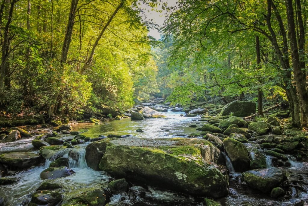
3. Fisherman’s Camp Trail
The Fisherman’s Campsite is found on Deep Creek and is the perfect place for fishing, photography, birdwatching, and hiking. This trail begins 1.3 miles west of Crab Flats Campground on the Forest Service Road, and the Crab Creek Trail provides the primary access to the Fisherman’s Camp.
You can drive from Lake Arrowhead to the campsite and start the hike there. You will have to get your toes wet to cross Deep Creek to hike the trail, which can be dangerous when the creek is running high. To camp at the Fisherman’s campsite, you will need to make a reservation.
This trail feels like a real step into the wilderness, but the rewards are worth it for the sense of solitude and the many wildflowers you’ll see along the way.
Length: 3 miles
Duration: 2h
Elevation: 159m
4. Deep Creek Hot Springs Trail
This is one of the more challenging trails that Lake Arrowhead offers and requires some particular preparation to make it an exceptional experience. But it’s one where you can enjoy a dip in natural hot springs!
This trail goes through the Deep Creek area that supports the most remarkable diversity of wildlife habits of any drainage system in the San Bernardino National Forest. Deep Creek is also State designated as a Wild Trout Stream. Look out for the Southwestern Arroyo Toad – an endangered toad that lives in the sandy creek shoreline.
The Pacific Crest Trail follows the creek from Lake Arrowhead to the Mojave River Forks Dam for 16 miles. Two trails lead to Deep Creek, one from Bowen Ranch and the second off Highway 173. You can park at Bowen Ranch, but will need a 4×4 and to pay for parking.
It is normal to see a lot of extra skin at the hot springs, so be prepared to encounter some nudity if you do decide to take a dip!
Length: 1.5 miles
Duration: 3h 10m
Elevation: 408m

Hiking in Lake Arrowhead: Our Final Thoughts
Exploring the hiking trails in Lake Arrowhead is the perfect way to spend a day out in the glorious San Bernardino National Forest.
You may need a 4×4 to reach some of the hiking trails, and there have been some recent closures of other trails in the area, which you can check online before hiking. There are plenty of hiking trails in Lake Arrowhead, so put on some hiking shoes, and get out and breathe the glorious fresh air in the Alps of Southern California!